
Why Kalindi Khal Trek is on every trekker's list
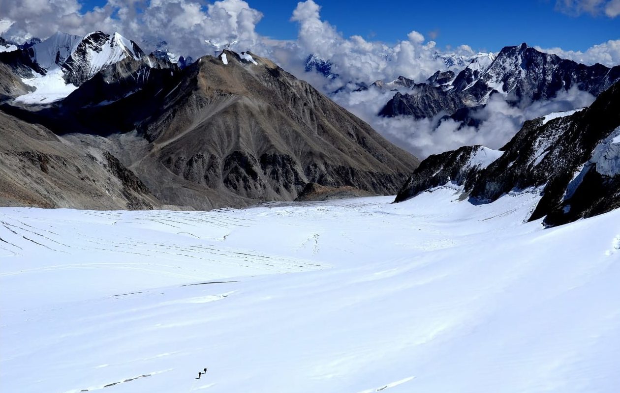
Few treks in the Indian Himalaya carry the weight — literal and metaphorical — of the Kalindi Khal trek. At 5,946 m (19,507 ft), the Kalindi Khal Pass is one of the highest trekking passes in India, a brutal glacier crossing that connects the sacred town of Badrinath in Chamoli district to Gangotri in Uttarkashi, threading through the heart of the Garhwal Himalayas. This is not a trail for the casually adventurous. It is a prestige route: a 10-to-14-day commitment across crevassed glaciers, loose moraines, and high-altitude snowfields where no mobile network reaches and no helicopter can guarantee quick access.
The reward? Unobstructed views of Kamet, Mana, Nilkantha, and the Bhagirathi peaks, a night beside the sacred Satopanth Lake, sunrise over the Shivling from Tapovan meadows, and the quiet authority that comes from having crossed one of the Himalaya's most respected passes. If you are serious about Himalayan trekking, the Kalindi Khal trek belongs on your list — but only when you are genuinely ready for it.
The Kalindi Khal trek earns its bucket-list status through sheer, uncompromising scale. Unlike more popular routes where teahouses buffer the experience, this crossing is raw wilderness for almost every kilometre. The route traverses two of India's most storied glaciers — the Satopanth Glacier and the Gangotri Glacier — and passes through the protected buffer zones of both Gangotri National Park and the Nanda Devi Biosphere Reserve.
The spiritual dimension is equally powerful. The journey begins at Badrinath (3,133 m), one of the Char Dham pilgrimage sites, passes through Mana Village, traditionally regarded as the last Indian village before the Tibetan plateau, and ends at Gangotri (3,048 m), the sacred source-town of the Ganges. For many trekkers, this is not merely a physical crossing — it is a traverse through living Hindu geography.
Practically, you are looking at approximately 100–120 km of total distance (flag: precise distance varies by source and route variation; 105–115 km is the most commonly cited range) and a 10–14 day commitment on trail, plus travel days either side. The views of Kamet (7,756 m), Nilkantha (6,596 m), and the Bhagirathi peaks from the approach and crossing are among the finest in Uttarakhand.
If you want a softer introduction to the Gangotri region, consider the Gangotri–Gaumukh–Tapovan trek first. For the Badrinath approach area, our Badrinath to Mana Village trek guide provides useful context.
At a glance
Ask TrekSage about Kalindi Khal Trek
Get instant answers grounded in verified trek data — beginner-friendliness, best months, permits, packing, and more.
The route at a glance
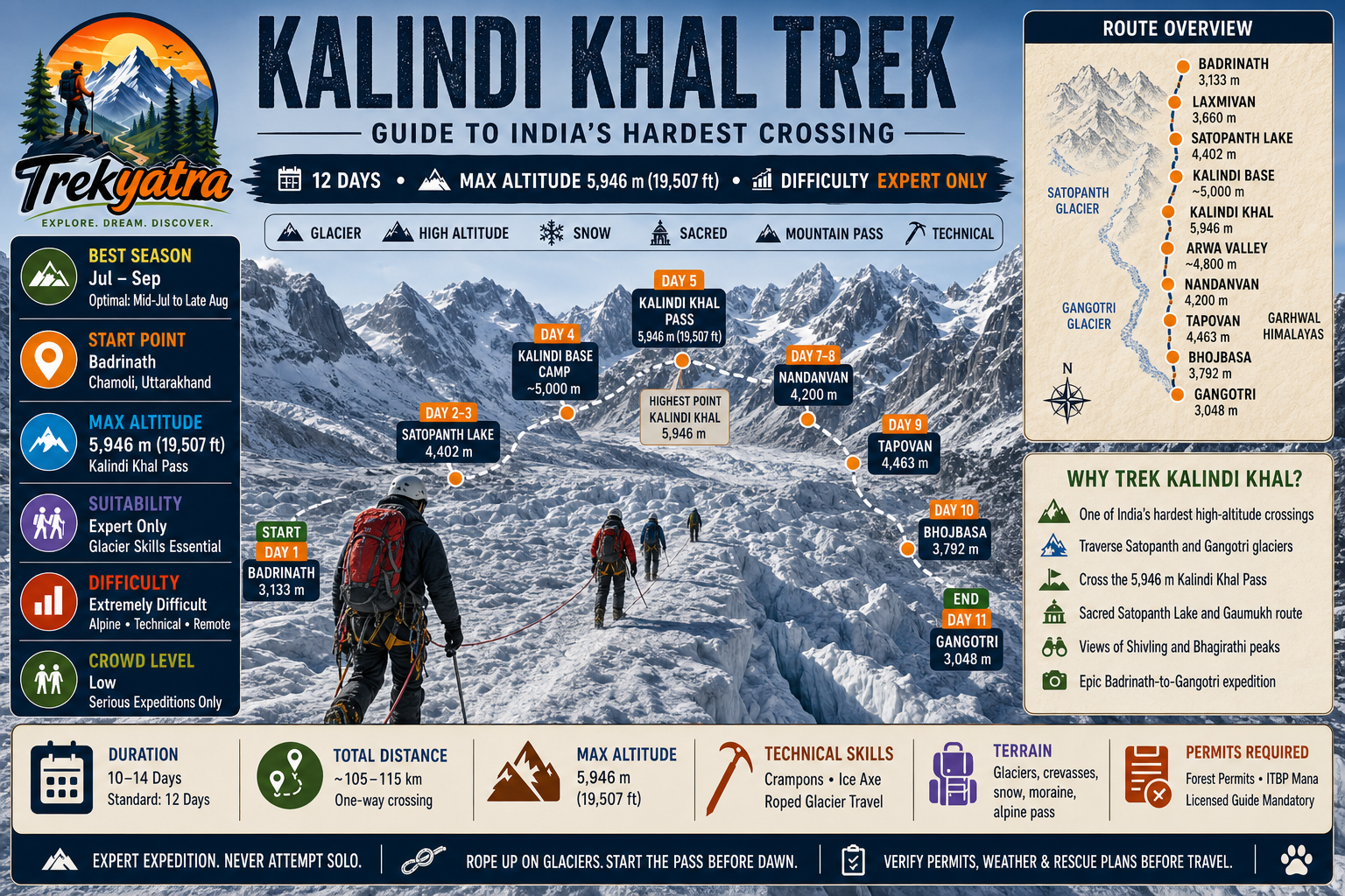
The route runs southwest from Badrinath to Gangotri, crossing from the Alaknanda river basin into the Bhagirathi river basin. After acclimatising around Badrinath and passing through Mana Village, the trail climbs the Satopanth Valley, a progressively remote corridor that leads to Satopanth Lake and then to the Kalindi Base Camp at roughly 5,000 m. The crossing of Kalindi Khal itself — the crux of the entire trek — involves glacier travel on the Satopanth and Gangotri glaciers, descent into the Arwa Valley, and a long walk out via Nandanvan, Tapovan, Bhojbasa, and finally Gangotri.
Total trail distance: approximately 105–115 km (flag: verify with latest DFO or GMVN maps; route variations exist).
Elevation Profile and Key Waypoints
| Campsite / Waypoint | Altitude |
|---|---|
| Badrinath | 3,133 m |
| Laxmivan | 3,660 m |
| Vasundhara Falls (en route) | ~3,700 m |
| Chakratirth | 4,340 m |
| Satopanth Lake | 4,402 m |
| Kalindi Base Camp | ~5,000 m |
| Kalindi Khal Pass | 5,946 m |
| Arwa Col Camp | ~4,800 m (flag: verify exact campsite altitude) |
| Nandanvan | 4,200 m |
| Tapovan | 4,463 m |
| Bhojbasa | 3,792 m |
| Gangotri | 3,048 m |
Key Landmarks Along the Route
Satopanth Lake is one of the trek's most sacred waypoints — a triangular glacial lake at 4,402 m whose three corners are, according to Hindu tradition, associated with Brahma, Vishnu, and Mahesh. It sits at the edge of the Satopanth Glacier and is a mandatory rest point both for its spiritual significance and for acclimatisation. Read our dedicated Satopanth Lake trek guide for the approach details.
Kalindi Khal Pass at 5,946 m is the absolute crux — a multi-hour glacier crossing with sustained exposure above 5,500 m. Crevasse fields demand rope-team discipline and crampon competence. The descent on the Gangotri side is steep and loose in late season.
Bhagirathi Kharak Glacier feeds the upper crossing and offers dramatic views of the Bhagirathi I, II, and III peaks towering above the snowfield.
Arwa Valley is one of Uttarakhand's least-visited corridors — a boulder-strewn, high-altitude valley below the western side of the pass that sees very few trekkers and no infrastructure.
Nandanvan is a broad alpine meadow at 4,200 m, sitting directly beneath the iconic pyramid of Shivling Peak (6,543 m). This is the mandatory acclimatisation and rest camp on the descent side.
Tapovan at 4,463 m on the lateral moraine of the Gangotri Glacier offers arguably the most famous Himalayan campsite in India — ringed by Shivling, Meru, and the Bhagirathi peaks.
What each day actually looks like
This 12-day plan is the standard framework. Add buffer days for weather or acclimatisation as needed — never compress days above 4,500 m.
Day 1 — Badrinath (3,133 m) to Laxmivan (3,660 m)
Begin at Badrinath. After completing ITBP registration at the Mana checkpoint and passing through Mana Village (last civilian settlement before the high valley), the trail follows the Alaknanda upstream. The walk is relatively straightforward — a 5–6 hour gradual ascent through open meadows alongside the river. Camp at Laxmivan.
Day 2 — Laxmivan (3,660 m) to Satopanth Lake (4,402 m)
Pass the spectacular Vasundhara Falls early in the day. The trail steepens as you gain the moraine leading to Satopanth Lake. Arrive by early afternoon to allow time for rest and acclimatisation. The lake's setting is extraordinary — a green-blue triangle ringed by moraines and glacier. 5–7 hours.
Day 3 — Satopanth Lake (4,402 m) — Acclimatisation / Rest Day or move to Chakratirth (4,340 m)
Many operators use today as a rest and acclimatisation day at Satopanth. Alternatively, a short relocation to Chakratirth (4,340 m, slightly lower) for a better launch point toward base camp. Explore the glacier margins, rest, hydrate heavily.
Day 4 — Chakratirth (4,340 m) to Kalindi Base Camp (~5,000 m)
This is a demanding ascent onto the lower Satopanth Glacier. Crampons may be required from mid-glacier. The route navigates around crevasse fields and over rolling ice. 6–8 hours. Camp at Kalindi Base Camp at approximately 5,000 m.
Day 5 — Kalindi Base Camp (~5,000 m) to Kalindi Khal Pass (5,946 m) and descent
The critical day. Start by 5:00–5:30 AM without exception to ensure you are on and off the pass before afternoon weather deteriorates. The ascent to the pass is 3–4 hours of sustained glacier climbing with fixed rope sections (flag: rope fixing depends on conditions and guide — verify current year practice). The summit view is extraordinary. Descend on the Gangotri side carefully; the upper descent is steep with loose moraine below the glacier. Camp on the Bhagirathi Kharak side at approximately 5,200–5,400 m (flag: exact campsite altitude varies by season and conditions).
Day 6 — High camp to Arwa Col Camp (~4,800 m)
Descend off the glacier onto the moraine of the Arwa Valley. This day requires careful route-finding on loose rock. 5–7 hours.
Day 7 — Arwa Col Camp (~4,800 m) to Nandanvan (4,200 m)
A long descent through the wild Arwa Valley, crossing boulder fields and glacier streams. Nandanvan camp at the base of Shivling is the first genuinely comfortable campsite in several days. 6–8 hours.
Day 8 — Nandanvan (4,200 m) — Acclimatisation / Rest Day
Mandatory rest. The body has been at extreme altitude for days. Use this day for gentle exploration of the meadows around Nandanvan and for drying gear. Shivling dominates the skyline. Check in with guides about the party's health before proceeding.
Day 9 — Nandanvan (4,200 m) to Tapovan (4,463 m)
A relatively short day across the lateral moraine of the Gangotri Glacier. Tapovan is a celebrated high camp — expect to share the meadow with mountaineering expeditions on Shivling and Meru. 3–4 hours.
Day 10 — Tapovan (4,463 m) to Bhojbasa (3,792 m)
Descend off the moraine onto the Gangotri Glacier trail, following the standard Gangotri–Gaumukh route. Pass Gaumukh (the glacier snout, the official source of the Ganges) and continue to Bhojbasa. 5–6 hours.
Day 11 — Bhojbasa (3,792 m) to Gangotri (3,048 m)
A well-maintained trail drops through the Bhagirathi gorge to Gangotri town. Celebrate with hot food, a bed, and — finally — mobile signal. 4–5 hours.
Day 12 — Buffer / Exit Day
Use this day for departure to Uttarkashi, Rishikesh, or Dehradun. If weather forced delays on any earlier day, this buffer absorbs them without breaking travel connections.
Acclimatisation and Rest Day Strategy
Acclimatisation is not optional on the Kalindi Khal trek — it is structural. The two rest days at Satopanth Lake and Nandanvan are built around the physiology of altitude adjustment, not comfort.
Above 4,000 m, aim to gain no more than 300–400 m of net altitude per sleep (the "climb high, sleep low" principle). Watch for early AMS symptoms: persistent headache, nausea, loss of appetite, fatigue disproportionate to effort, and disturbed sleep. At or above 4,500 m, any rapid deterioration — confusion, loss of coordination, wet cough, breathlessness at rest — requires immediate descent. Do not wait for symptoms to resolve at altitude. See our detailed guide on altitude sickness prevention for Himalayan treks.
Diamox (Acetazolamide) is commonly used as a prophylactic; consult your physician before the trek.
When to go
The Kalindi Khal trek has a narrow, non-negotiable seasonal window: mid-July to late August is the only genuinely viable period for most trekking parties. Here is the season-by-season breakdown:
- April–June (Pre-monsoon): The pass and upper glaciers carry heavy, unstable winter snowpack. Avalanche risk is extremely high. Not recommended.
- Early July: Snow consolidation begins but the pass remains heavily loaded. High avalanche risk on both approach and descent slopes. Only experienced mountaineers with appropriate training should consider this window.
- Mid-July to late August (Optimal): Snow is consolidated, glaciers are stable, crevasse patterns are known by experienced guides, and daylight hours are long enough for safe crossing. This is the 2026 season window to target.
- September: Temperatures drop rapidly after mid-September. Early season snowfall can close the pass with little warning. Days shorten significantly. A small window in early September is possible for experienced parties but requires daily weather assessment.
- October onwards: Pass is effectively closed. Extreme cold, ice-glazed rock, and limited daylight make crossing dangerous.
Be aware that afternoon thunderstorms in August are common throughout the Garhwal. The golden rule: be off the pass and descending by noon at the absolute latest, ideally by 10–11 AM.
Is this trek right for you?
Grade: Extremely Difficult / Alpine
The Kalindi Khal trek sits at the upper boundary of what is achievable without formal mountaineering certification, but do not mistake accessible for easy. The difficulty derives from several compounding factors:
- Sustained glacier travel across the Satopanth and Gangotri glaciers, with active crevasse fields
- A pass at 5,946 m requiring 4–5 hours of exertion above 5,000 m
- No rescue infrastructure for the central 5-to-7-day section of the route
- Multi-day remote exposure with zero mobile connectivity
- Loose moraine navigation at altitude, which is exhausting and technically demanding
- Weather unpredictability that can trap parties above 5,000 m
This trek is harder than Roopkund and significantly harder than Pin Bhaba Pass. It is broadly comparable in technical demand to Friendship Peak, though the summit push on Friendship Peak is more concentrated.
Fitness baseline: You should be able to carry a 12–15 kg pack for 7–8 hours consecutively on consecutive days before beginning this trek. A structured 3–4 month training programme of loaded hiking, stair climbing, and cardiovascular conditioning is the minimum preparation.
What Technical Skills Do You Need for the Kalindi Khal Trek?
This is non-negotiable. You must arrive with:
- Crampon fitting and walking — you must be able to move efficiently and confidently on 30–40° glacier ice
- Ice axe self-arrest — ability to stop a slide on glacier snow is a survival skill, not a nice-to-have
- Rope travel on glaciers — all glacier sections should be completed roped in teams of 3–4
- Weather reading — ability to recognise deteriorating conditions and make conservative decisions
Recommended prior experience: At minimum, Roopkund, Har Ki Dun, and Rupin Pass (or equivalent grade B treks). Ideally, you should have completed a Basic Mountaineering Course (BMC) from NIM Uttarkashi (Nehru Institute of Mountaineering) or HMI Darjeeling (Himalayan Mountaineering Institute) before attempting this crossing.
What permits you need
Permits for the Kalindi Khal trek are multi-layered and change with some regularity. Verify requirements with the relevant offices at least 3 months before your departure date.
1. Forest Department Entry Permit — Gangotri National Park / Chamoli Forest Division
Required for entry into the protected forest buffer zones on both the Gangotri and Badrinath sides of the crossing. Obtain from:
- DFO Office, Uttarkashi (for Gangotri National Park access)
- DFO Office, Chamoli (for the Badrinath / Satopanth approach)
- Online via the Uttarakhand Forest Department portal (flag: verify portal URL and current online processing availability for 2026 before travel — portal functionality has varied year to year)
Approximate cost: INR 150–300 per person per day of forest area transit (flag: 2026 rates — verify with DFO office as fees are revised annually). Camera/video fees are additional. For a step-by-step guide, see how to get Uttarakhand forest permits.
2. ITBP / BRO Checkpoint Registration at Mana
All trekkers must register with the ITBP (Indo-Tibetan Border Police) at the Mana checkpoint before proceeding up the Satopanth Valley. Carry original government photo ID (Aadhaar, passport). No additional fee typically applies here, but documentation must be in order.
3. Inner Line Permit
Not typically required for Indian nationals on the standard Kalindi Khal route (flag: verify current rules for 2026 — proximity to the international border means regulations can change at short notice; foreign nationals should check with their operator and the Uttarakhand state administration).
4. GMVN Registration
Some operators process group registration through GMVN (Garhwal Mandal Vikas Nigam). Confirm with your operator whether this is handled centrally.
Group size: A minimum of 4 trekkers is recommended by local authorities. A licensed guide is mandatory — attempting the glacier crossing without a qualified, locally registered guide may violate permit conditions and is genuinely dangerous.
What this trek will cost you
DIY (Per Person, 2026 Estimates)
| Item | Estimated Cost (INR) |
|---|---|
| Forest permits (12 days) | 1,500 – 3,000 |
| Guide + porter (INR 2,000–3,000/day × 12 days) | 24,000 – 36,000 |
| Food and ration | 5,000 – 8,000 |
| Transport (Dehradun–Badrinath–Gangotri–Rishikesh) | 3,000 – 5,000 |
| Gear rental (crampons, ice axe, sleeping bag top-up) | 3,000 – 5,000 |
| Total DIY estimate | ~40,000 – 60,000 |
Flag: All cost estimates above are 2026 projections based on trend data; verify guide and porter day rates with local agencies in Badrinath/Uttarkashi, as rates have risen with inflation.
Guided Package (Reputed Operator)
All-inclusive packages from established operators: approximately INR 25,000–45,000 per person for groups of 6–10 (flag: verify current 2026 operator pricing directly; package costs vary significantly by operator and inclusion scope). Packages typically include guide, porter, camping equipment, meals on trail, and permit processing. Transport and personal gear are usually excluded.
Hidden and Emergency Costs to Budget For
- Travel insurance with helicopter evacuation cover: Mandatory. Budget INR 500–2,000 for a 15-day policy (flag: premium varies by insurer and coverage level — obtain quotes from at least two providers before booking).
- Altitude medication (Diamox, Dexamethasone): INR 500–1,000. Consult your physician for prescriptions before travel.
- Extra porter if personal carry exceeds 15 kg: Additional INR 1,500–2,500 per day.
- Emergency satellite phone or SPOT device rental: INR 2,000–5,000 for the trek duration. Strongly recommended given zero mobile coverage for the central section.
What to pack
Weight discipline is critical — target under 15 kg personal carry.
Technical Gear
- Crampons (10–12 point; can be rented in Badrinath or Uttarkashi — flag: verify rental availability for 2026 season)
- Ice axe (60–65 cm; rental available but owning is preferable)
- Sit harness and locking carabiner (for roped glacier travel)
- Climbing helmet
- Quality trekking poles (2 × collapsible, with snow baskets)
- Gaiters (knee-height, waterproof)
Clothing
- Moisture-wicking base layers (2 sets)
- Mid-weight fleece or softshell
- Down jacket rated to -10°C or colder
- Hardshell jacket and trousers (waterproof, windproof)
- Mountaineering boots (double-boot or insulated single; crampon-compatible)
- Liner gloves + insulated outer mitts
- Balaclava and warm hat
- High-SPF sun protection (lips, face, neck)
- Glacier goggles (Category 4; non-negotiable at 5,900+ m)
Camping
- 4-season tent (operator-provided on guided treks; if DIY, essential)
- Sleeping bag rated to -15°C
- Insulated sleeping mat
Navigation and Safety
- GPS device with downloaded topo maps (or smartphone with offline maps + power bank)
- Topographic map of the Badrinath–Gangotri crossing
- Personal Locator Beacon (PLB) or SPOT satellite communicator
Medical Kit
- Diamox (Acetazolamide) — prescribed
- Dexamethasone — prescribed, for HACE emergency
- Nifedipine — prescribed, for HAPE emergency
- Ibuprofen, antihistamine, rehydration salts, blister kit, antiseptic
Documents
- Original government photo ID
- All printed permits
- Insurance policy document and emergency contact numbers
- Emergency cash (INR — no ATMs after Badrinath)
Staying safe on the mountain
Altitude Illness (AMS / HACE / HAPE)
Above 4,500 m, treat any deteriorating symptoms seriously. A worsening headache that does not respond to ibuprofen and hydration, combined with loss of coordination, altered consciousness, or wet breathlessness, demands immediate descent — not observation, not Diamox alone. Descend at least 300–500 m and reassess. HACE and HAPE can be fatal within hours. See our altitude sickness prevention guide.
Glacier Safety
- Never walk on glacier terrain unroped. Crevasses are often snow-bridged and invisible from above.
- Rope teams of 3–4 with correct spacing (8–10 m intervals on low-angle glacier).
- Probe suspicious snow bridges before committing weight.
- Avoid solo travel at any point on the route.
Weather Windows
- Begin the pass crossing no later than 5:00–5:30 AM. The summit should be reached and the descent begun by 8:00–9:00 AM. Be below the technical glacier sections before noon.
- Monitor for afternoon cumulonimbus build-up from 11 AM. Lightning on the exposed glacier is an extreme hazard.
Wildlife
The route passes through snow leopard and bharal (blue sheep) habitat. There is no documented threat to trekkers, but maintain respectful distance and do not leave food unattended at camp.
Emergency Contacts
- SDRF Uttarkashi: 01374-222373 (flag: verify this number is current for 2026)
- ITBP Joshimath: Contact via your registered operator or nearest checkpoint
- Uttarakhand Police Helpline: 112
- Carry a PLB or SPOT device — there is no mobile network from above Mana until Gangotri town.
Similar treks to explore
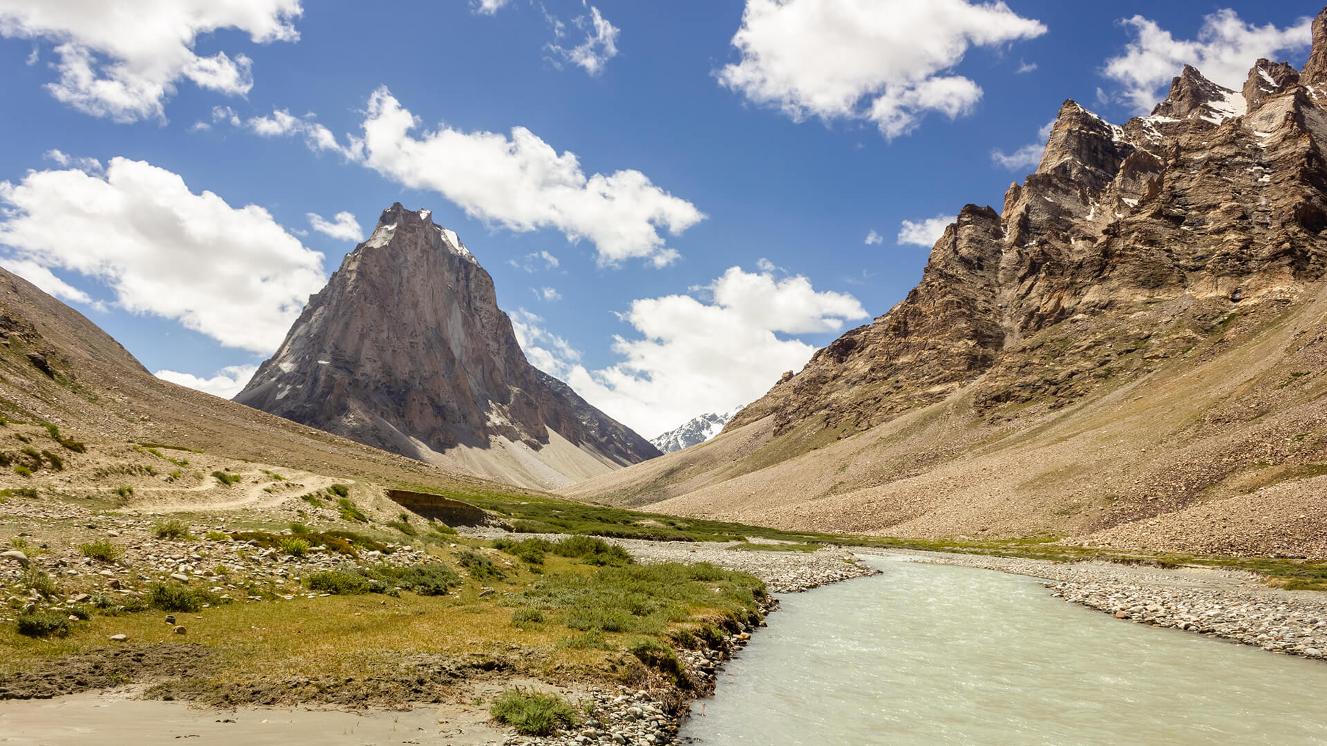
Padum to Darcha Trek: Complete High-Altitude Route Guide
The Padum to Darcha trek covers ~115–120 km in 8–9 days, crossing Shingo La (~5,060 m) between Zanskar and Lahaul.
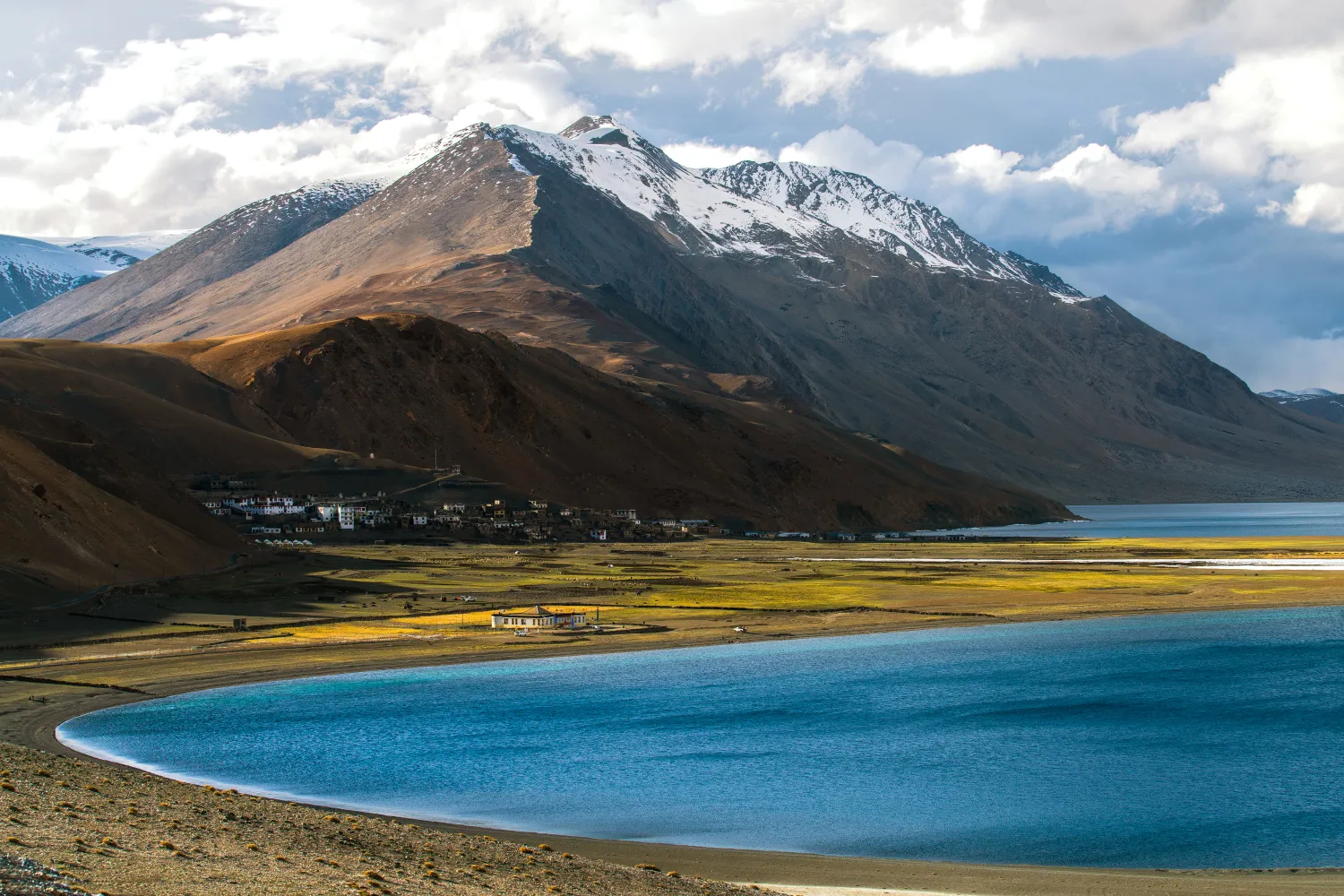
Rumtse to Tso Moriri Trek: Complete Ladakh Trail Guide
The Rumtse to Tso Moriri trek is an ~80 km, 7–8 day strenuous Ladakh trail crossing Kyamar La (~5,460 m) and Polokongka La (~5,190 m), ending at Tso Moriri Lake
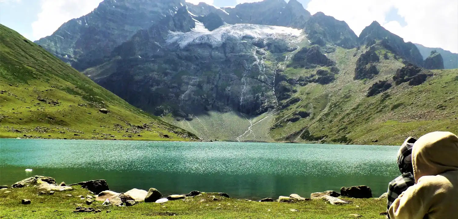
Naranag Gangabal Trek: Complete Guide (2026)
The Naranag Gangabal Trek is a 4–5 day moderate-difficult alpine trek in Kashmir, covering ~26–30 km from Naranag (2,150 m) to Gangabal Lake (3,570 m).
Common questions answered
The highest point is Kalindi Khal Pass at 5,946 m (19,507 ft), making it one of the highest trekking passes in India that can be crossed without formal mountaineering certification. However, the altitude demands full acclimatisation preparation, glacier skills, and physical conditioning that goes well beyond standard trekking.
Kalindi Khal Trek — Latest News
Live Conditions
Real-time weather & trail status
Trail Conditions
Crowdsourced reports from trekkers who've done this route
Sign in to add a trip report
Find a Trek Buddy
Connect with trekkers planning the same route
No buddies yet for this trek
Sign in and be the first to post a planning signal.