
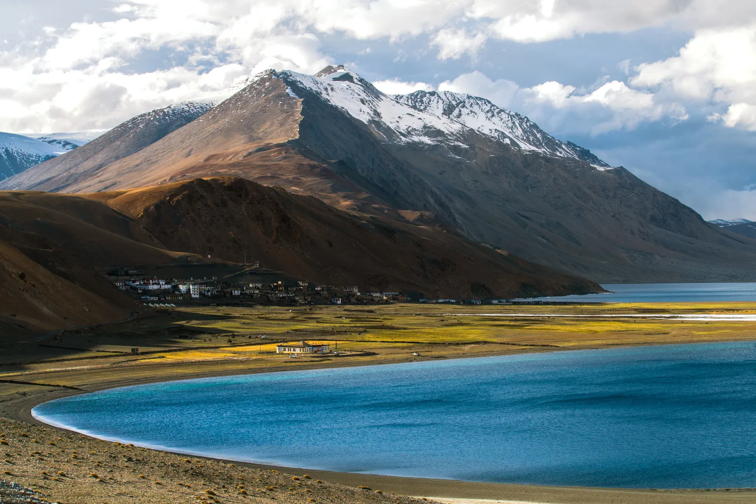
Why Rumtse to Tso Moriri Trek is on every trekker's list
In the constellation of best treks in Ladakh, the Rumtse to Tso Moriri route occupies a special place — it is demanding enough to filter out casual trekkers, yet accessible enough for well-prepared enthusiasts with prior high-altitude experience.
Solitude and Remoteness
Where the Markha Valley trek has become a well-trodden circuit with tea houses and growing crowds, the Rumtse–Tso Moriri trail retains an untamed character. For several consecutive days you may encounter nothing but wind, wildlife, and the occasional Changpa nomad herding pashmina goats.
Wildlife Encounters
The route passes through prime habitat for some of Ladakh's most iconic wildlife:
- Kiang (Tibetan wild ass): Commonly spotted in herds across the Rupshu plateau.
- Tibetan wolf: Seen occasionally stalking the high meadows.
- Snow leopard: Rare but possible; the Tso Moriri Wildlife Sanctuary is one of the better zones in Ladakh for sightings.
- Bar-headed geese and black-necked cranes: Visible at Tso Moriri Lake during migration seasons.
High-Altitude Passes
Crossing Kyamar La and Polokongka La provides visceral, 360-degree panoramas across the Rupshu and Changthang plateaus — landscapes that feel more Tibetan than Indian.
Cultural Richness
Small villages and nomadic camps along the way offer glimpses into Changpa pastoral life that has changed little over centuries. The trail ends at Korzok, a village of profound spiritual significance, home to Korzok Monastery.
The Tso Moriri Finale
Tso Moriri Lake (4,522 m) is the crowning reward — a 28 km long, cobalt-blue body of water ringed by snow-streaked mountains and protected within the Tso Moriri Wildlife Sanctuary (officially the Tsomoriri Wetland Conservation Reserve).
At a glance
Ask TrekSage about Rumtse to Tso Moriri Trek
Get instant answers grounded in verified trek data — beginner-friendliness, best months, permits, packing, and more.
The route at a glance
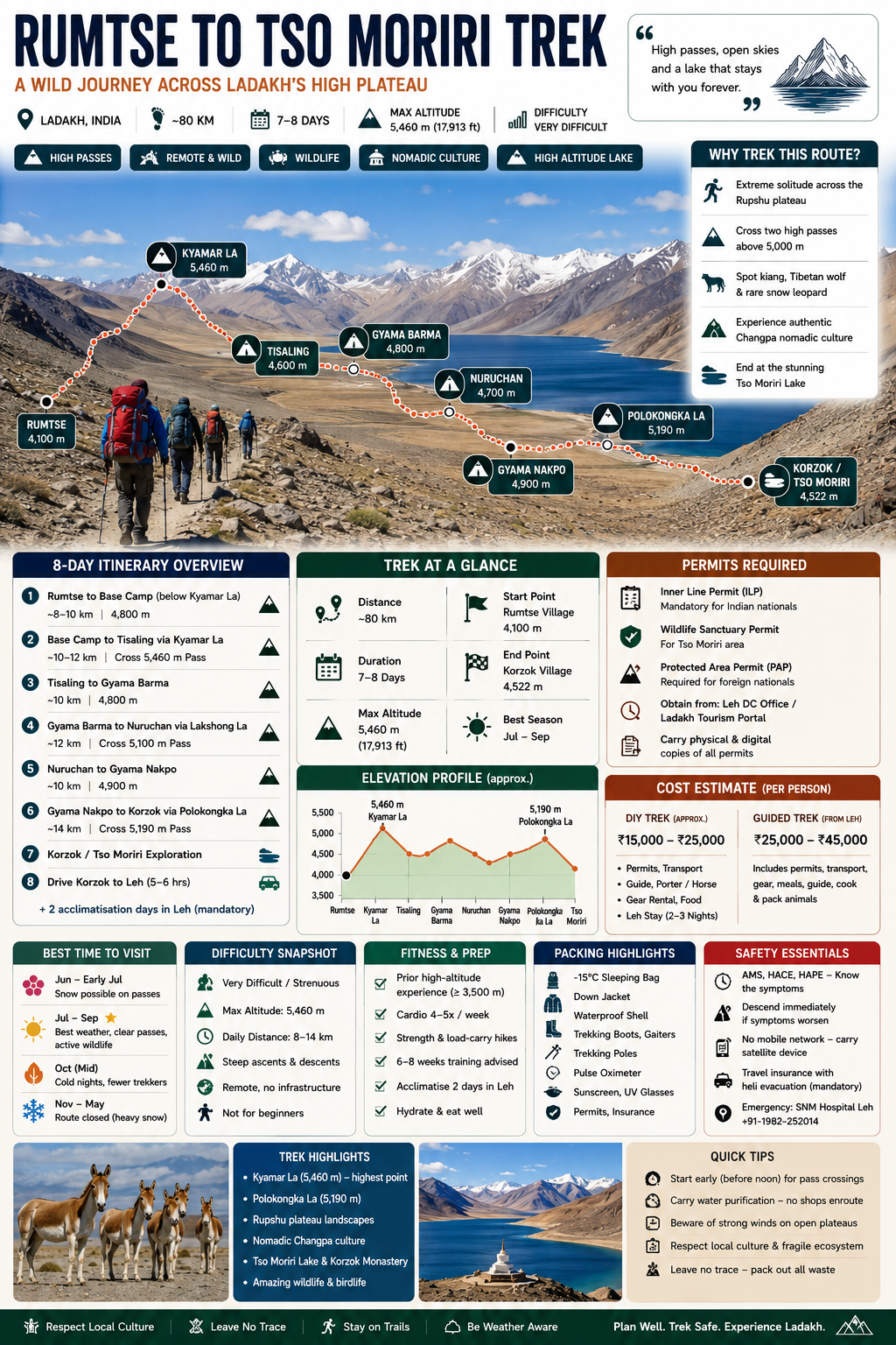
The Rumtse to Tso Moriri trek is an ~80 km, 7–8 day strenuous high-altitude trail in Ladakh crossing two passes above 5,000 m — Kyamar La (~5,460 m) and Polokongka La (~5,190 m) — ending at sacred Tso Moriri Lake (4,522 m). Best season: July–September.
Few treks in the Indian Himalaya combine raw wilderness, dramatic high passes, ancient nomadic culture, and the soul-stirring finale of a high-altitude lake quite like the Rumtse to Tso Moriri trek. Stretching approximately 80 km through the remote southern flanks of Ladakh, this trail links the roadside hamlet of Rumtse village — just off the Leh–Manali Highway — to the sacred Tso Moriri Lake and the village of Korzok, sitting at roughly 4,522 m above sea level.
Unlike the increasingly busy Markha Valley trek, the Rumtse to Tso Moriri route sees far fewer trekkers, meaning genuine solitude across most of its high-altitude terrain. The trail crosses two major passes above 5,000 m — Kyamar La (~5,460 m) and Polokongka La (~5,190 m) — threads through high-altitude meadows grazed by kiang (Tibetan wild ass), and descends into the Tso Moriri Wildlife Sanctuary, one of Ladakh's most ecologically significant protected areas.
⚠️ Note on 2026 season: The 2026 trekking season runs from approximately late June to early October. Permit regulations and fees have been updated below; always verify the latest rules with the Leh DC office before departing.
Quick Stats
| Detail | Info |
|---|---|
| Total Distance | ~80 km |
| Duration | 7–8 trekking days (+ 2 acclimatisation days in Leh) |
| Maximum Altitude | ~5,460 m (Kyamar La) |
| Difficulty | Strenuous / Challenging |
| Best Season | July – September |
| Start Point | Rumtse village, Ladakh |
| End Point | Korzok village, Tso Moriri |
| Permits Required | ILP, Wildlife Sanctuary Permit (PAP for foreign nationals) |
The trek begins at Rumtse village (~4,100 m), a small settlement straddling the Leh–Manali Highway, and progresses south-eastward across the high Rupshu plateau before descending to Korzok on the western shore of Tso Moriri.
General Elevation Profile:
From Rumtse, the trail climbs steeply to Kyamar La (~5,460 m) on Day 2, the highest point of the entire route. After descending to the Tisaling campsite, subsequent days involve a series of rollercoaster ascents and descents across secondary passes before the final crossing of Polokongka La (~5,190 m) and the descent to Korzok.
Key Waypoints (approximate altitudes):
| Waypoint | Altitude (approx.) |
|---|---|
| Rumtse village (start) | ~4,100 m |
| Kyamar La (Pass 1) | ~5,460 m |
| Tisaling campsite | ~4,600 m |
| Gyama Barma campsite | ~4,800 m |
| Lakshong La | ~5,100 m |
| Nuruchan campsite | ~4,700 m |
| Gyama Nakpo campsite | ~4,900 m |
| Polokongka La (Pass 2) | ~5,190 m |
| Korzok / Tso Moriri (end) | ~4,522 m |
Route Maps: Printed topographic maps (1:50,000 scale) are available from select bookshops in Leh's main bazaar. Digital GPX tracks can be downloaded from reputable trekking platforms; always carry a paper backup as mobile data is unavailable on the trail. See our Ladakh trekking guide for recommended map sources.
Key Passes and Campsites on the Rumtse to Tso Moriri Route
Passes:
| Pass | Altitude (approx.) | Difficulty |
|---|---|---|
| Kyamar La | ~5,460 m | Hard — steep ascent/descent |
| Lakshong La | ~5,100 m | Moderate–Hard |
| Polokongka La | ~5,190 m | Moderate–Hard |
Key Campsites:
- Tisaling: First major camp after Kyamar La descent; flat ground beside a stream; ~4,600 m.
- Gyama Barma: Mid-route camp in a broad valley; good grazing for horses; ~4,800 m.
- Nuruchan: Remote camp with nomadic presence possible; water source nearby; ~4,700 m.
- Gyama Nakpo: Final high camp before Polokongka La; exposed, bring full cold-weather kit; ~4,900 m.
⚠️ Campsite altitudes are approximate and sourced from field reports. Verify with your guide or a recent expedition account before departure.
What each day actually looks like
Allow 2 full acclimatisation days in Leh (3,500 m) before starting the trek. This is non-negotiable at these altitudes.
Day 0 — Arrive Leh (3,500 m)
Fly into Leh's Kushok Bakula Rimpochhe Airport. Rest completely. Eat light, stay hydrated, avoid alcohol. Check permit requirements and confirm your trekking arrangements.
Day 0+1 — Acclimatisation Day 1, Leh
Short walks around the old town — Leh Palace, Shanti Stupa. No strenuous activity. Start Diamox if prescribed. Gather permits from the DC office.
Day 0+2 — Acclimatisation Day 2, Leh / Drive to Rumtse
Optionally drive to Rumtse (~2.5 hrs from Leh on the Manali Highway) and spend the night in the village. This is a gentle altitude gain and helps the body adjust before Day 1 of actual trekking.
Day 1 — Rumtse (~4,100 m) to below Kyamar La base camp (~4,800 m)
- Distance: ~8–10 km
- Altitude gain: ~700 m
- Highlights: Rumtse village gompa, dramatic canyon scenery, first views of Kyamar La
- Camp: Meadow camp below the pass
Day 2 — Base camp to Tisaling via Kyamar La (~5,460 m)
- Distance: ~10–12 km
- Altitude: Cross Kyamar La, descend to Tisaling (~4,600 m)
- This is the hardest day — early start (by 5:30 AM) recommended to avoid afternoon winds
- Highlights: 360° panorama from Kyamar La; first sight of the Rupshu plateau
- Camp: Tisaling
Day 3 — Tisaling (~4,600 m) to Gyama Barma (~4,800 m)
- Distance: ~10 km
- Altitude: Moderate gain through open valleys
- Highlights: Kiang herds, vast open plateaus, nomadic camps
- Camp: Gyama Barma
Day 4 — Gyama Barma to Nuruchan via Lakshong La (~5,100 m)
- Distance: ~12 km
- Highlights: Lakshong La crossing, sweeping views toward the Changthang plateau
- Camp: Nuruchan (~4,700 m)
Day 5 — Nuruchan (~4,700 m) to Gyama Nakpo (~4,900 m)
- Distance: ~10 km
- Altitude: Gradual gain
- Highlights: Dramatic rock formations, possible Tibetan wolf sighting
- Camp: Gyama Nakpo — prepare for cold night
Day 6 — Gyama Nakpo to Korzok via Polokongka La (~5,190 m)
- Distance: ~14 km
- Altitude: Cross Polokongka La, long descent to Korzok
- Highlights: First views of Tso Moriri from the pass; Korzok Monastery; arrival at the lake
- Camp / Guesthouse: Korzok village (~4,522 m)
Day 7 — Korzok / Tso Moriri Exploration
- Rest and explore Tso Moriri Lake
- Visit Korzok Monastery (one of the highest monasteries in the world)
- Wildlife watching: bar-headed geese, black-necked cranes, kiang on the lakeshore
- Depart by shared taxi or arranged vehicle to Leh (approx. 5–6 hours via Chumathang)
Sample 8-Day Itinerary at a Glance
| Day | Route | Distance | Max Altitude | Campsite/Stay |
|---|---|---|---|---|
| 0+1 | Arrive Leh — rest | — | 3,500 m | Leh guesthouse |
| 0+2 | Acclimatise / drive to Rumtse | — | 4,100 m | Rumtse village |
| 1 | Rumtse → Pass base camp | ~8–10 km | ~4,800 m | Meadow camp |
| 2 | Base camp → Tisaling via Kyamar La | ~10–12 km | ~5,460 m | Tisaling |
| 3 | Tisaling → Gyama Barma | ~10 km | ~4,800 m | Gyama Barma |
| 4 | Gyama Barma → Nuruchan via Lakshong La | ~12 km | ~5,100 m | Nuruchan |
| 5 | Nuruchan → Gyama Nakpo | ~10 km | ~4,900 m | Gyama Nakpo |
| 6 | Gyama Nakpo → Korzok via Polokongka La | ~14 km | ~5,190 m | Korzok village |
| 7 | Explore Tso Moriri / drive back to Leh | — | 4,522 m | Leh |
When to go
Ladakh lies in the rain shadow of the Greater Himalaya, meaning the monsoon barely touches this region. This gives the Rumtse to Tso Moriri trek a much longer viable season than most Himalayan routes.
June – Early July (Early Season)
The trail opens as snowpack recedes from the passes. Expect some residual snow on Kyamar La and Polokongka La in early June. Days are long and temperatures relatively mild, but river crossings can be swollen with snowmelt. Best for experienced trekkers comfortable with variable snow conditions.
July – September (Peak Season — Recommended)
This is the optimal window for the Rumtse to Tso Moriri trek. Passes are reliably clear, weather is stable, wildflowers carpet the meadows, and wildlife is active. Nights remain cold (down to -5°C to -10°C at high camps) but days are pleasant at 10–18°C in valleys.
October (Late Season)
An excellent option for those seeking even greater solitude. Temperatures drop sharply after mid-October; sub-zero nights become common at all elevations. The trail remains passable through mid-October for well-equipped trekkers, but conditions deteriorate quickly. Expect a more austere, golden-hued landscape.
November – May (Route Closed)
Passes are snow-bound and impassable. The extreme cold (down to -30°C in winter at Korzok) and lack of any support infrastructure make this season completely unsuitable for this route.
Recommendation for 2026: Plan for the July–August window for the best combination of open passes, stable weather, and active wildlife. The 2026 season is expected to follow standard patterns, but check current conditions with Leh-based operators in June.
Is this trek right for you?
The Rumtse to Tso Moriri trek is rated Strenuous / Challenging — it is not a beginner route.
Why it's demanding:
- Maximum altitude of ~5,460 m at Kyamar La places this in serious high-altitude territory
- Daily distances of 10–14 km with significant elevation gains
- No rescue infrastructure or permanent habitation on most of the route
- Rapidly changing weather; temperature can drop from +15°C to -10°C within hours
Who should attempt this trek:
- Trekkers with prior experience at 3,500 m or above (e.g., Roopkund, Stok Kangri base, or similar)
- Those with a baseline of cardiovascular fitness — able to run 5 km comfortably, cycle regularly, or practise hiking on hilly terrain
- Ideally, trekkers who have completed at least one multi-day Himalayan trek before
Fitness Training (6–8 weeks before):
- Cardio: Running, cycling, or stair climbing 4–5x per week
- Strength: Quad-focused exercises (lunges, squats) for descent endurance
- Load-bearing walks with a 10–12 kg pack on hilly terrain
Altitude Sickness Risk:
The risk of Acute Mountain Sickness (AMS) is significant on this route, particularly on Day 2 when crossing Kyamar La. Tso Moriri altitude sickness risk is also present upon arriving at the 4,522 m lake after multiple days of exertion. Spend adequate time acclimatising in Leh — see our high-altitude trekking India guide for protocols.
First-time trekkers: This route is not recommended without a certified guide and prior high-altitude experience.
What permits you need
The Tso Moriri region is a Restricted/Protected Area, and multiple permits are required before beginning this trek.
1. Inner Line Permit (ILP)
Mandatory for all Indian nationals entering the Tso Moriri restricted zone.
- Cost (2026): Approximately ₹200–₹400 per person
- Where to obtain: Leh District Collectorate (DC) office, or online via the Ladakh Tourism portal (lahdc.nic.in or the current official portal)
- Documents needed: Government-issued photo ID (Aadhaar, passport, voter ID), 2 passport-size photos
- Processing time: Usually same-day if applied in person; 1–2 days online
2. Tso Moriri Wildlife Sanctuary / Wetland Conservation Reserve Entry Permit
- Required on entry to the Korzok/Tso Moriri zone
- Often issued at the sanctuary check post; your ILP may cover this — verify with the DC office in 2026
3. Protected Area Permit (PAP) — Foreign Nationals Only
- All foreign nationals must obtain a PAP in addition to any ILP equivalent
- Cost:
- Obtainable through registered travel agents in Leh or the DC office
- Passport copies and visa details required
4. Environmental / Forest Fee
- A nominal environmental protection fee may be levied at certain checkpoints
- Amount varies; carry ₹200–₹500 in small notes for this purpose
For a full breakdown of all Ladakh permits, see our dedicated Ladakh permits guide. Permit rules in Ladakh are administered by the Ladakh Autonomous Hill Development Council (LAHDC) and are subject to annual revision.
What this trek will cost you
DIY Trek Cost Breakdown (per person, 2026 estimates)
| Expense | Estimated Cost (INR) |
|---|---|
| Permits (ILP + sanctuary fees) | ₹500–₹800 |
| Transport Leh–Rumtse (shared taxi) | ~₹2,000–₹2,500 |
| Transport Korzok–Leh (return, shared) | ~₹2,000–₹3,000 |
| Guide (8 days @ ₹1,500–₹2,000/day) | ₹12,000–₹16,000 |
| Pack horse/porter (8 days @ ₹1,200–₹1,500/day) | ₹9,600–₹12,000 |
| Camping gear rental (tent, sleeping bag) | ₹2,000–₹4,000 |
| Food (carried provisions for 7 days) | ₹3,000–₹5,000 |
| Leh accommodation (2–3 nights) | ₹1,500–₹3,000 |
| DIY Total (approx.) | ₹15,000–₹25,000 |
Cost estimates are indicative for 2026. Guide and horseman rates are set locally and vary by season and negotiation. Always agree on rates in writing beforehand.
Organised / Guided Package from Leh
| Package Type | Estimated Cost (INR, per person) |
|---|---|
| Budget operator (shared group, 8 pax+) | ₹25,000–₹32,000 |
| Mid-range operator (4–6 pax) | ₹32,000–₹40,000 |
| Premium / private expedition | ₹40,000–₹55,000 |
Guided packages typically include permits, transport, camping equipment, meals, guide, cook, and pack animals. They do not typically include personal travel insurance, sleeping bag (often rental), or alcohol.
For comparison shopping on Ladakh treks, see our Ladakh trekking guide.
What to pack
Packing right for a 5,460 m trek in Ladakh is a matter of safety, not comfort. See our comprehensive Ladakh packing list for the full breakdown; key items are summarised below.
Clothing — Layer System:
- Moisture-wicking base layer (top and bottom) × 2 sets
- Mid-layer fleece or softshell jacket
- Down jacket (600+ fill power, rated to -10°C or below)
- Waterproof hardshell jacket and trousers
- Trekking trousers × 2
- Warm hat, balaclava, sun hat
- Gloves (thin liner + waterproof outer shell)
- Wool/synthetic trekking socks × 5–6 pairs
Footwear:
- High-ankle waterproof trekking boots (broken in before the trek)
- Lightweight camp shoes / sandals
- Gaiters (essential for snow on passes)
Gear:
- 4-season tent (if DIY) or confirm operator provides one
- Sleeping bag rated to -15°C (non-negotiable for Gyama Nakpo and pass camps)
- Trekking poles × 2
- 50–60 litre trekking backpack + 20 litre daypack
- Headlamp + spare batteries
- Water purification (SteriPen or tablets)
- 2–3 litre water carrying capacity
- Sunglasses (glacier-rated, UV400)
- Sunscreen SPF 50+, lip balm with SPF
Nutrition:
- High-energy snacks: nuts, dried fruit, energy bars, dark chocolate
- Electrolyte sachets / ORS packets
- Trail meals if self-catering
Medical Kit:
- Diamox (acetazolamide) — consult your doctor before the trek; standard prophylactic dose 125–250 mg twice daily
- Ibuprofen / paracetamol
- Blister care kit (Compeed, moleskin)
- Pulse oximeter (essential — monitor SpO2 daily)
- Dexamethasone (carry for HACE/HAPE emergency — only use if trained)
- Antiseptic cream, bandages, medical tape
- Personal prescription medications
Documents:
- ILP / PAP (keep physical copies + digital backup)
- Government-issued photo ID
- Travel insurance policy with helicopter evacuation cover (physical + digital)
- Emergency contacts list
Essential Gear Checklist for the Rumtse to Tso Moriri Trek
Non-Negotiables for High-Altitude Trekking India:
- ☐ Sleeping bag rated -15°C
- ☐ Down jacket
- ☐ Waterproof shell (jacket + trousers)
- ☐ High-ankle waterproof boots
- ☐ Gaiters
- ☐ Trekking poles
- ☐ Pulse oximeter
- ☐ Diamox (doctor-prescribed)
- ☐ Headlamp with spare batteries
- ☐ Water purification
- ☐ Sun protection (SPF 50+, UV glasses)
- ☐ All permits (ILP / PAP) — physical copies
- ☐ Travel insurance with heli-evac
- ☐ Emergency contact numbers written down
Staying safe on the mountain
This section is not optional reading — at altitudes above 5,000 m, poor decisions kill. Study it carefully before you trek.
Acute Mountain Sickness (AMS) — Recognise the Signs:
- Headache, nausea, fatigue, loss of appetite, dizziness
- If symptoms are mild, rest at current altitude, hydrate, take ibuprofen
- Do NOT ascend further until completely symptom-free
High Altitude Cerebral Oedema (HACE) — Medical Emergency:
- Severe headache unresponsive to medication, confusion, loss of coordination, inability to walk straight
- Descend immediately — do not wait until morning
High Altitude Pulmonary Oedema (HAPE) — Medical Emergency:
- Breathlessness at rest, persistent dry cough, pink frothy sputum, extreme fatigue
- Descend immediately and activate emergency evacuation
Acclimatisation Protocol:
- Spend minimum 2 full nights in Leh (3,500 m) before starting the trek
- Follow the "climb high, sleep low" principle where possible
- Ascend no more than 300–500 m per night above 4,000 m
Hydration and Lifestyle:
- Drink 3–4 litres of water daily on the trail
- Avoid alcohol for the first 3 days in Ladakh
- Eat even if you have no appetite — calorie deficit worsens AMS
Emergency Contacts and Evacuation:
- SNM Hospital Leh: +91-1982-252014 (24-hour emergency)
- Nearest helipad points: Rumtse (road access), Korzok village (helipad exists for emergency use)
- Inform your operator or a contact in Leh of your daily itinerary
- Carry a satellite communicator (SPOT, Garmin inReach) if trekking with a small group — no mobile signal on most of this route
- Travel insurance with helicopter evacuation is mandatory, not optional. A helicopter evacuation from Rupshu can cost ₹2–₹4 lakh or more
Other Safety Considerations:
- Never cross a pass alone
- Carry a paper map and compass as backup
- Weather can change within 30 minutes at 5,000 m+ — always start pass crossings early (before noon)
- Water sources are plentiful but always purify before drinking
For detailed advice on altitude illness, see our guides on Ladakh acclimatisation tips and high-altitude trekking India.
Similar treks to explore
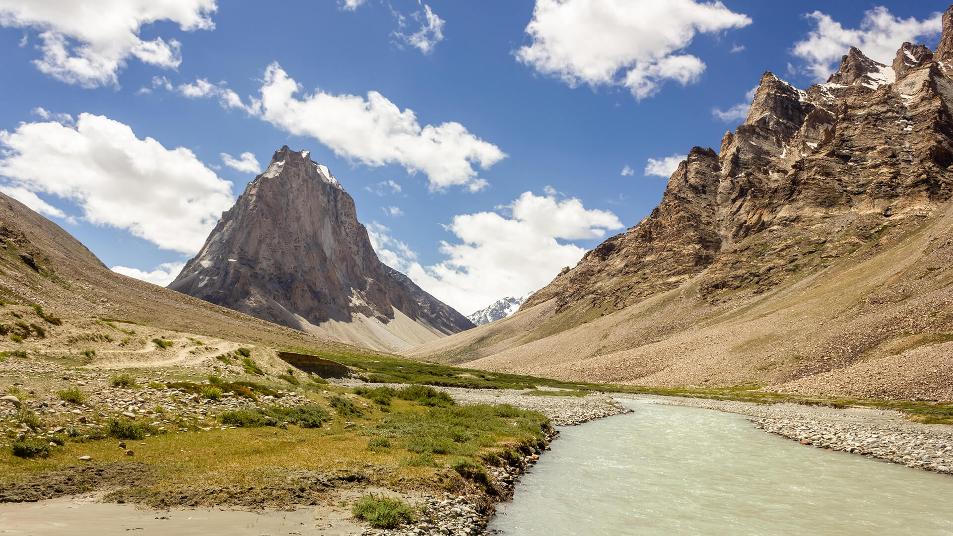
Padum to Darcha Trek: Complete High-Altitude Route Guide
The Padum to Darcha trek covers ~115–120 km in 8–9 days, crossing Shingo La (~5,060 m) between Zanskar and Lahaul.
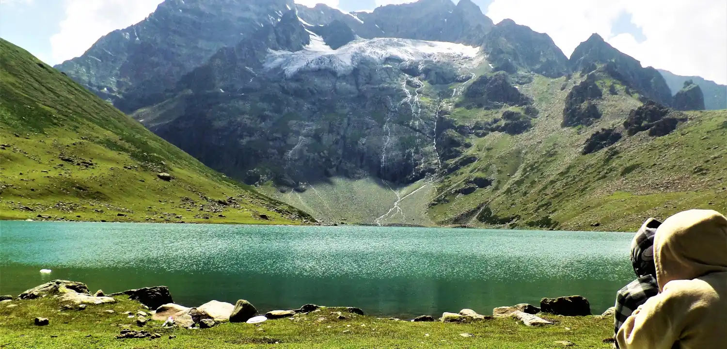
Naranag Gangabal Trek: Complete Guide (2026)
The Naranag Gangabal Trek is a 4–5 day moderate-difficult alpine trek in Kashmir, covering ~26–30 km from Naranag (2,150 m) to Gangabal Lake (3,570 m).
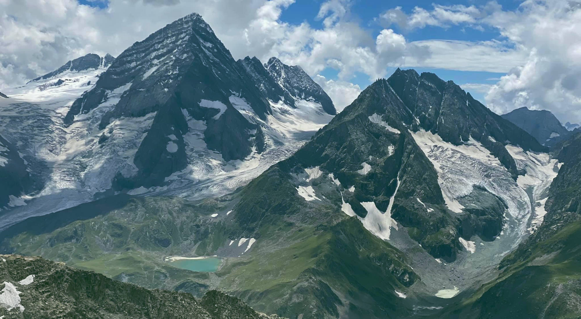
Kolahoi Glacier Trek: Complete Kashmir Guide 2026
The Kolahoi Glacier Trek is a moderate-to-challenging 6-day route from Aru Valley near Pahalgam to Kashmir's largest glacier at 4,100 m.
Common questions answered
The Rumtse to Tso Moriri trek is rated Strenuous / Challenging. It reaches a maximum altitude of approximately 5,460 m at Kyamar La, involves daily distances of 8–14 km with significant elevation gain and loss, and takes place in remote terrain without rescue infrastructure. Prior high-altitude trekking experience at 3,500 m or above is strongly recommended. First-time Himalayan trekkers should not attempt this route without an experienced guide.
Rumtse to Tso Moriri Trek — Latest News
Live Conditions
Real-time weather & trail status
Trail Conditions
Crowdsourced reports from trekkers who've done this route
Sign in to add a trip report
Find a Trek Buddy
Connect with trekkers planning the same route
No buddies yet for this trek
Sign in and be the first to post a planning signal.