
Why Roopkund Trek is on every trekker's list
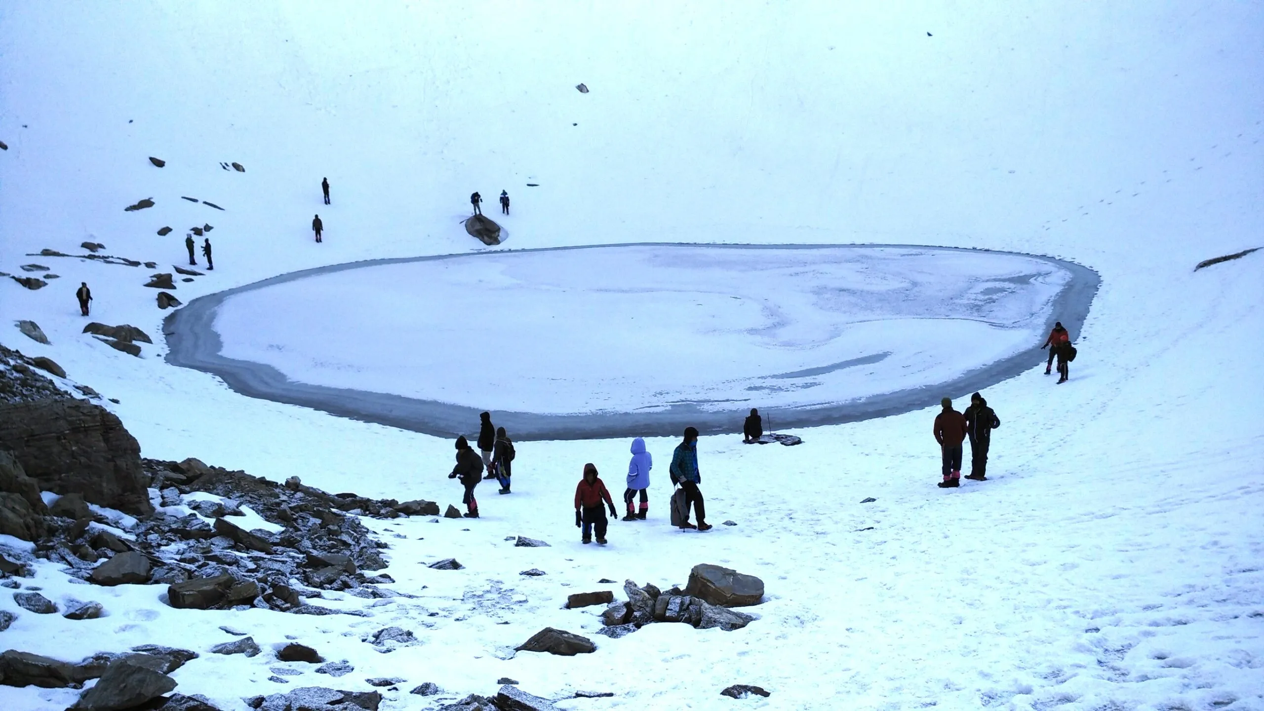
Hidden at 5,029 metres in the Chamoli District of Uttarakhand, Roopkund Lake is not your average alpine destination. Every time the snow melts in summer, the lake reveals its grim secret: hundreds of ancient human skeletons scattered along its frozen shores. This haunting phenomenon has earned it the name Skeleton Lake, and it draws trekkers, scientists, and storytellers from across the world.
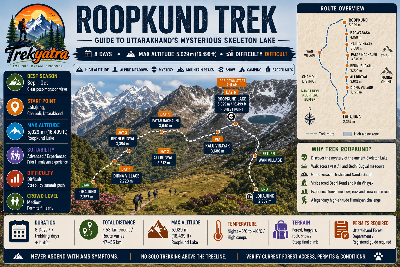
Beyond the mystery, the Roopkund trek is a masterclass in Himalayan grandeur. You walk through some of the finest high-altitude meadows in India — Ali Bugyal and Bedni Bugyal — with sweeping views of Trishul Peak and Nanda Ghunti framing the sky. The full circuit covers approximately 53 km over 8 days, starting and ending at Lohajung in the Garhwal Himalayas.
Whether you are an experienced trekker wondering if Roopkund belongs on your bucket list, or a curious traveller trying to understand what the fuss is about, this guide covers everything you need for the 2026 trekking season.
India has hundreds of Himalayan treks. So why does Roopkund consistently rank among the top ten? Several reasons set it apart.
The Skeleton Lake mystery is the obvious hook, but the trek earns its reputation on terrain alone. The trail passes through Ali Bugyal and Bedni Bugyal — two of the most expansive and beautiful alpine meadows in the Garhwal Himalayas. At sunrise, when Trishul (7,120 m) and Nanda Ghunti (6,309 m) catch the first light, the views are genuinely world-class.
The trek also sits within the Nanda Devi Biosphere Reserve, a UNESCO World Heritage-adjacent protected area, giving every step an ecological significance. The biodiversity here — from Himalayan monal pheasants to Brahmakamal flowers — adds layers to what could otherwise be a purely altitude-chasing exercise.
Groing popularity has brought better trail infrastructure and more operators to the route, making it more accessible than a decade ago — though it remains firmly in the 'Difficult' category and is not suitable for beginners.
The Skeleton Lake Mystery
In the 1940s, a British forest ranger reportedly stumbled upon Roopkund Lake and discovered hundreds of skeletal remains half-submerged in the water and scattered on the surrounding slopes. Estimates of the total number of individuals range from approximately 300 to 800, though pinning down an exact count remains difficult given the disturbed state of the site.
For decades, theories ranged from an ancient epidemic to a freak hailstorm wiping out a single group of pilgrims. Then in 2019, a landmark study published in Nature Communications (conducted by a team including Harvard Medical School researchers) used DNA analysis to upend all previous assumptions. The study found that the skeletons were not from a single event but represented multiple distinct genetic populations — including groups with South Asian ancestry, people genetically similar to populations from the eastern Mediterranean or Crete, and individuals from Southeast Asia. The Mediterranean-origin individuals were estimated to have died between the 17th and 20th centuries CE, making it unlikely they were all part of one pilgrimage or military expedition.
The study ignited fresh debate. How did people from the Mediterranean end up at 5,029 m in the Himalayas? No consensus explanation exists. This unresolved mystery is precisely what gives Roopkund its global cultural gravity and draws researchers, journalists, and trekkers in equal measure.
At a glance
Ask TrekSage about Roopkund Trek
Get instant answers grounded in verified trek data — beginner-friendliness, best months, permits, packing, and more.
The route at a glance
The classic Roopkund route is a circuit beginning and ending at Lohajung (2,357 m), a small village in Chamoli District accessible by road from Haridwar. The trail does not simply go up and come back the same way — it loops through distinct terrain, offering variety throughout.
Key waypoints:
Lohajung → Didna Village → Ali Bugyal → Bedni Bugyal → Patar Nachauni → Kalu Vinayak → Bagwabasa → Roopkund → (return via same high route or variant descent)
Approximate elevation profile:
- Lohajung: 2,357 m — trail start, forested lower slopes
- Didna: 2,720 m — gradual ascent through oak and rhododendron forest
- Ali Bugyal: 3,612 m — first major meadow, expansive views begin
- Bedni Bugyal: 3,354 m — larger meadow, campsite, ancient Bedni Kund temple
- Patar Nachauni: 3,640 m — rocky terrain, treeline ends
- Kalu Vinayak: 3,680 m — Ganesh temple, steep ascent begins
- Bagwabasa: 4,150 m — last campsite before the summit push
- Roopkund Lake: 5,029 m — the destination
The elevation profile is not linear. The trail dips after Ali Bugyal to reach Bedni Bugyal before climbing steeply again, which is why acclimatisation happens naturally if you follow the recommended itinerary.
Roopkund Trek Distance and Altitude Breakdown
| Camp | Altitude (m) | Altitude (ft) | Distance from Previous Camp |
|---|---|---|---|
| Lohajung (Base) | 2,357 m | 7,733 ft | — |
| Didna Village | 2,720 m | 8,924 ft | ~6 km |
| Ali Bugyal | 3,612 m | 11,850 ft | ~8 km |
| Bedni Bugyal | 3,354 m | 11,004 ft | ~5 km |
| Patar Nachauni | 3,640 m | 11,942 ft | ~6 km |
| Kalu Vinayak | 3,680 m | 12,073 ft | ~2 km |
| Bagwabasa | 4,150 m | 13,615 ft | ~5 km |
| Roopkund Lake | 5,029 m | 16,499 ft | ~5 km |
Total circuit distance: approximately 53 km. Note: some operators cite distances between 47–55 km depending on the descent variation used. Flag for route-specific verification.
What each day actually looks like
Day 0 — Travel Day: Haridwar / Kathgodam to Lohajung
Most trekkers begin their journey from Haridwar (nearest major railhead to the Roopkund trailhead) or Kathgodam (nearest railhead if approaching from Delhi via Kumaon). The road distance from Haridwar to Lohajung is approximately 250 km and takes 10–12 hours by road. Overnight buses or early-morning private taxis are the most practical options. Plan to arrive in Lohajung by evening, check into a guesthouse, and rest. See the detailed transport section below.
Day 1 — Lohajung to Didna Village
- Distance: ~6 km
- Altitude gain: 2,357 m → 2,720 m (+363 m)
- Walking time: 3–4 hours
- Highlights: The trail drops first into the Neel Ganga river valley before climbing to Didna, a traditional Garhwali village. Rhododendron and oak forests dominate. A gentle introduction to the route.
Day 2 — Didna to Ali Bugyal
- Distance: ~8 km
- Altitude gain: 2,720 m → 3,612 m (+892 m)
- Walking time: 5–6 hours
- Highlights: This is the day the trek reveals itself. Ali Bugyal is one of Asia's largest alpine meadows. The grassland stretches for kilometres at over 3,500 m, with the first unobstructed views of the Himalayan peaks emerging as you climb.
Day 3 — Ali Bugyal to Bedni Bugyal
- Distance: ~5 km
- Altitude change: 3,612 m → 3,354 m (slight descent)
- Walking time: 3–4 hours
- Highlights: A relatively relaxed day that allows for acclimatisation. Bedni Bugyal is home to the ancient Bedni Kund, a sacred lake, and a temple. Panoramic views of Trishul and Nanda Ghunti are at their best from here in clear conditions.
Day 4 — Bedni Bugyal to Patar Nachauni via Kalu Vinayak
- Distance: ~8 km
- Altitude gain: 3,354 m → 3,640 m (+286 m)
- Walking time: 5–6 hours
- Highlights: The trail passes through Kalu Vinayak (3,680 m), a small Ganesh shrine considered auspicious by pilgrims on the Nanda Devi Raj Jat Yatra route. Beyond Kalu Vinayak, the trail becomes more exposed and rocky. Patar Nachauni campsite sits at the edge of the treeline.
Day 5 — Patar Nachauni to Bagwabasa
- Distance: ~5 km
- Altitude gain: 3,640 m → 4,150 m (+510 m)
- Walking time: 4–5 hours
- Highlights: Terrain turns alpine and barren. Snow patches appear from October onwards. Bagwabasa (meaning 'place to stay before the storm') is your last camp before Roopkund. Acclimatisation at this altitude is critical — rest well, eat adequately, and hydrate.
Day 6 — Bagwabasa to Roopkund and Back to Bedni Bugyal
- Distance: ~15 km (round trip Roopkund + descent to Bedni)
- Altitude: 4,150 m → 5,029 m → 3,354 m
- Walking time: 8–10 hours (the longest day)
- Highlights: The summit push to Roopkund begins before dawn (typically 4–5 AM). The final ascent is steep, often icy, and demands trekking poles or micro-spikes. At the lake, skeletons remain visible around the shoreline when snow recedes. The descent to Bedni Bugyal is long but on familiar terrain. This is the most physically and emotionally intense day of the trek.
Day 7 — Bedni Bugyal to Lohajung (via Wan Village, alternate descent)
- Distance: ~12 km
- Altitude loss: 3,354 m → 2,357 m
- Walking time: 6–7 hours
- Highlights: Many operators descend via Wan Village, a slightly different return route that passes through dense forest and rural Garhwali settlements — a welcome contrast to the high-altitude barrenness of previous days. Arrive at Lohajung by afternoon.
Day 8 — Buffer / Departure Day
Built into the itinerary as a weather buffer or rest day. If weather delayed the Roopkund summit on Day 6, this day can be used for another attempt. Otherwise, begin the return journey to Haridwar or Kathgodam.
Roopkund Trek from Haridwar: How to Reach Lohajung
By Road (Recommended):
The standard route from Haridwar follows: Haridwar → Rishikesh → Devprayag → Karnaprayag → Tharali → Mundoli → Lohajung. Total distance is approximately 250 km, taking 10–12 hours depending on road conditions and stops.
- Bus: Uttarakhand Roadways operates buses from Haridwar to Tharali/Karnaprayag. From Tharali, shared jeeps run to Mundoli and Lohajung (confirm local availability before travel). Budget approximately ₹400–₹700 for bus fare one way.
- Private Taxi / Cab: Direct taxis from Haridwar to Lohajung cost approximately ₹4,000–₹6,000 per vehicle. Sharing between a group of 4–5 trekkers makes this economical.
- Overnight option: Many trekkers travel overnight to save a day. Rishikesh or Karnaprayag are good overnight halt points if a two-day road journey is preferred.
Nearest Railhead:
- Haridwar (on Delhi–Dehradun railway line, well connected to all major cities)
- Kathgodam (nearest railhead via Kumaon approach; approximately 180 km from Lohajung via Almora and Kausani — this route is longer but scenic)
See our detailed guide: Haridwar to Lohajung Travel Guide
When to go
The Roopkund trek is a seasonal route. Getting the timing right is critical for safety and experience quality.
May – June (Pre-Monsoon, ✅ Open)
This window offers excellent visibility, manageable temperatures, and significant snow at higher camps — ideal for trekkers who want to experience snow-covered meadows. Wildflowers begin blooming in the bugyals. Temperatures at Roopkund can dip to -5°C to -10°C at night. May is considered a sweet spot — snow bridges are intact and crowds are moderate. Carry micro-spikes and gaiters.
July – August (Monsoon, ❌ Closed)
The trek is effectively closed during the peak monsoon. Landslides are frequent on the approach roads, the trail becomes dangerously slippery, leeches proliferate in lower forest zones, and visibility at the lake is poor due to persistent cloud cover. Most reputable operators do not run trips during this period. Do not attempt this trek in July or August.
September – October (Post-Monsoon, ✅ Peak Season)
Generally regarded as the best time for the Roopkund trek. Skies are crystal clear after the monsoon washes the atmosphere clean. Views of Trishul and Nanda Ghunti are at their sharpest. Temperatures are colder but manageable. The skeletons at Roopkund Lake are most visible as summer snowmelt has cleared the shoreline. Crowds peak in late September and early October — book permits and operators well in advance.
November – April (Winter / Post-Season, ❌ Closed)
Heavy snowfall makes the upper sections of the trail impassable from November onwards. Lohajung itself can be cut off by snow. This window is considered dangerous and not recommended for recreational trekking without specialised mountaineering equipment and experience.
Is this trek right for you?
Overall Grade: Difficult
Roopkund is not a beginners' trek. Here is why:
- You spend 3+ days at altitudes above 4,000 m, significantly increasing the risk of Acute Mountain Sickness (AMS).
- The final ascent from Bagwabasa to Roopkund gains nearly 900 m in approximately 5 km on steep, often icy terrain.
- Day 6 is a 10+ hour day combining a high-altitude push with a long descent — physically demanding even for fit trekkers.
- Weather can change rapidly above 4,500 m, turning benign conditions dangerous within hours.
Who Should Attempt This Trek:
Trekkers who have prior Himalayan experience at altitudes of 3,000 m or above are best suited. Completing treks like Kedarkantha (3,810 m) or Brahmatal (3,862 m) first is strongly recommended before attempting Roopkund.
Recommended 8-Week Training Plan:
- Weeks 1–2: Daily 45-minute brisk walks or jogs; bodyweight squats and lunges
- Weeks 3–4: Add stair climbing (15–20 floors daily); increase run duration to 5 km
- Weeks 5–6: Weekend hikes with a loaded daypack (8–10 kg); core strengthening
- Weeks 7–8: Practice back-to-back long days; simulate uphill with treadmill incline
Not Recommended For: First-time trekkers, those with cardiac or respiratory conditions, people who have not been active for 6+ months, and anyone who has not spent a night above 3,000 m before.
Also see: Altitude Sickness Prevention Guide
What permits you need
A valid permit is mandatory for the Roopkund Trek. Do not enter the trail without one — rangers conduct checks at multiple points, and trekkers without permits are turned back.
Permit Authority: Uttarakhand Forest Department, managed through the SRFMTC (Shri Ram Forest Management & Tourism Corporation) portal.
How to Obtain:
- Online: Through the official SRFMTC portal (visit the Uttarakhand Forest Department website). Upload a valid government ID — Aadhaar Card is mandatory for Indian nationals.
- At Lohajung: A check post at Lohajung also issues permits, but it is advisable to obtain them online before travel to avoid queues, especially during peak season.
Permit Cost (2026): Approximately ₹600–₹800 per person per trek.
Daily Trekker Cap: Following conservation regulations enforced from 2023 onwards, a cap of 40 trekkers per day is enforced at the Roopkund entry point. During September–October, permits can fill up weeks in advance. Book early.
Nanda Devi Biosphere Reserve: The upper portions of the trek fall within the buffer zone of the Nanda Devi Biosphere Reserve. Trekkers must abide by strict Leave No Trace rules — no plastic, no campfires above 3,000 m, and waste must be carried out.
Full permit guide: Trekking Permits in Uttarakhand
What this trek will cost you
DIY Trekking Cost
| Expense | Estimated Cost (INR) |
|---|---|
| Transport (Haridwar ↔ Lohajung, both ways) | ₹2,500–₹4,000 |
| Forest permit | ₹600–₹800 |
| Local guide (8 days × ₹1,200/day) | ₹9,600 |
| Tent + sleeping bag rental | ₹1,500 |
| Food on trail (₹500/day × 8 days) | ₹4,000 |
| Guesthouse in Lohajung (2 nights) | ₹1,000–₹1,500 |
| Miscellaneous (porter, medication, tips) | ₹1,500–₹2,000 |
| Total DIY Estimate | ₹20,700–₹23,400 |
Note: Hiring a certified local guide is legally required for solo trekkers under the no-solo-trekking rule. It is also strongly recommended for safety reasons.
Organised Package Cost
- Budget operators: ₹14,000–₹22,000 per person (typically includes guide, camping equipment, meals on trail, and basic transport from Kathgodam or Haridwar)
- Mid-range and premium operators (e.g., Indiahikes, Trek The Himalayas): ₹28,000–₹35,000 per person (includes safety equipment, rescue protocol, experienced trek leaders, insurance assistance, waste management compliance)
What packages typically include: Trek permit, meals during trek, camping equipment, guide, first-aid support, porters for camp equipment
What packages typically exclude: Personal travel insurance, personal trekking gear, transport to base camp, tips for crew
Tipping Norms: It is customary to tip guides ₹500–₹1,000 per person for the full trek, and porters ₹300–₹500 per person. Tips are genuinely appreciated and form a meaningful part of the crew's income.
Compare top operators: Best Trek Operators in India
What to pack
Keep your pack weight under 12 kg (excluding water). Porters are available but excessive pack weight will slow you down above 4,000 m.
Clothing:
- Moisture-wicking base layer (top + bottom, 2 sets)
- Insulating mid layer (fleece jacket or down vest)
- Hardshell waterproof jacket and trousers
- Warm insulated jacket (down or synthetic, rated to -10°C)
- Trekking trousers (2 pairs, no cotton)
- Thermal gloves + outer shell gloves
- Balaclava or neck gaiter + warm hat
- Gaiters (essential for snow sections)
- Wool or synthetic hiking socks (4–5 pairs)
Footwear:
- High-ankle waterproof trekking boots (broken in before the trek — do not debut new boots on Roopkund)
- Camp sandals or lightweight shoes for evenings
- Micro-spikes (mandatory for May–June; highly recommended September–October above 4,500 m)
Gear:
- Trekking poles (pair, adjustable)
- 50–60 litre backpack with rain cover
- Daypack (20–25L) if porters carry main bag
- Headlamp with spare batteries
- Sunglasses (Category 3 or 4 UV protection — critical at altitude)
- Sunscreen SPF 50+ and lip balm
- Reusable water bottles (2 × 1L minimum)
- Water purification tablets or filter
Camping (if DIY):
- Four-season tent (or 3-season with good insulation)
- Sleeping bag rated to -10°C minimum
- Sleeping mat / insulated pad
Safety and Medical:
- Personal first-aid kit (blister plasters, bandages, antiseptic)
- Diamox (Acetazolamide) — consult your doctor before the trek; standard protocol is 125 mg twice daily starting 24 hours before ascent above 3,000 m (flagged for medical review — confirm dosage with a qualified physician)
- ORS sachets (4–6)
- Pulse oximeter (essential for monitoring SpO2 above 4,000 m)
- Ibuprofen, antihistamines, anti-diarrhoeal medication
- Emergency whistle
Documents:
- Trek permit (printed copy + digital backup)
- Government-issued photo ID (Aadhaar card mandatory)
- Travel insurance documents (high-altitude cover, including helicopter evacuation)
- Emergency contact list
Full gear guide: Himalayan Trek Gear List
Staying safe on the mountain
Acute Mountain Sickness (AMS):
AMS is the biggest risk on the Roopkund trek. Symptoms include persistent headache, nausea, dizziness, and breathlessness at rest. The golden rule: never ascend with symptoms. If AMS symptoms appear, descend immediately — even 300–500 m of descent can dramatically relieve symptoms. The itinerary built into this guide includes natural acclimatisation (the Bedni Bugyal dip and rest days) — do not skip these.
Carry a pulse oximeter. SpO2 readings below 85% at rest above 4,000 m are a warning sign; below 80% is an emergency.
Diamox Protocol: Many trekkers and trek doctors recommend Diamox (Acetazolamide) as a prophylactic above 3,000 m. Consult your physician before the trek — it is not suitable for everyone, particularly those with sulfa drug allergies.
Weather and Afternoon Thunderstorms:
Above 4,000 m, afternoon thunderstorms are common in both pre- and post-monsoon seasons. Start each high-altitude day early (before 6 AM) and aim to be at camp by early afternoon. If caught in lightning exposure above the treeline, descend immediately and stay away from ridge lines.
No Solo Trekking:
Uttarakhand trekking regulations introduced after 2022 require trekkers to be accompanied by a registered local guide above the treeline. Solo unguided trekking on Roopkund is prohibited. This is both a legal requirement and a genuine safety measure.
Mobile Network:
Expect reliable mobile connectivity only at Lohajung. Beyond that, network coverage is sporadic to non-existent. BSNL has the broadest coverage in this region; Airtel has patchy signal at some camp points. Inform someone trustworthy of your day-wise itinerary and check-in schedule before leaving.
Emergency Contacts and Evacuation:
- Uttarakhand Tourism Emergency Helpline: 1364
- Local rescue (Chamoli District): Contact trek operators or the Lohajung check post for current emergency numbers (verify locally before trek)
- Nearest government hospital: Base Hospital Chamoli, approximately 100 km from Lohajung
- Helicopter evacuation landing pads exist at Bedni Bugyal and Lohajung for serious emergencies
Travel Insurance:
High-altitude travel insurance with helicopter evacuation cover is non-negotiable. Helicopter rescues from Bedni Bugyal cost upwards of ₹1,50,000 — ensure your policy covers rescues above 5,000 m.
Water Safety:
Do not drink directly from streams, however clean they look. Use purification tablets or a filter — giardia is a real risk on popular trekking routes.
In-depth reading: Altitude Sickness Prevention Guide
Similar treks to explore
Rumtse to Tso Moriri Trek: Complete Ladakh Trail Guide
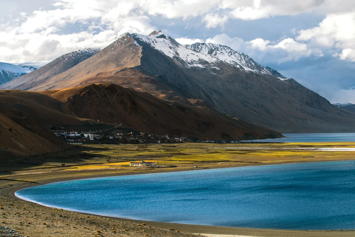
The Rumtse to Tso Moriri trek is an ~80 km, 7–8 day strenuous Ladakh trail crossing Kyamar La (~5,460 m) and Polokongka La (~5,190 m), ending at Tso Moriri Lake
Naranag Gangabal Trek: Complete Guide (2026)
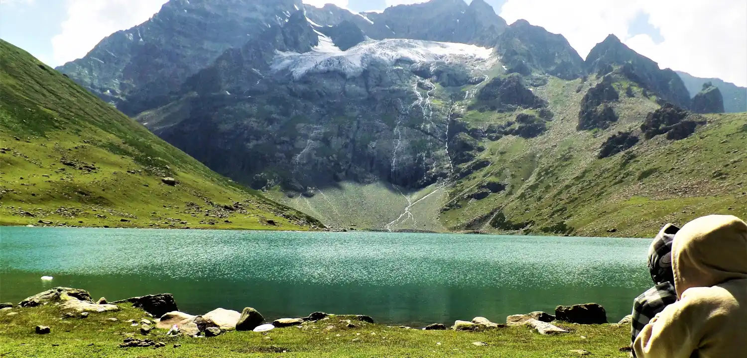
The Naranag Gangabal Trek is a 4–5 day moderate-difficult alpine trek in Kashmir, covering ~26–30 km from Naranag (2,150 m) to Gangabal Lake (3,570 m).
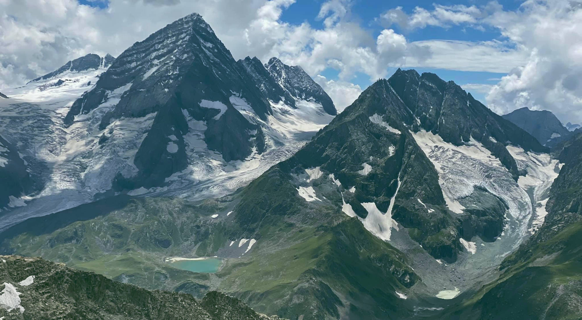
Kolahoi Glacier Trek: Complete Kashmir Guide 2026
The Kolahoi Glacier Trek is a moderate-to-challenging 6-day route from Aru Valley near Pahalgam to Kashmir's largest glacier at 4,100 m.
Common questions answered
The two ideal windows are May–June (pre-monsoon) and September–October (post-monsoon). May offers snow-covered landscapes and moderate crowds; September–October delivers the clearest skies and best visibility of Trishul and Nanda Ghunti. The trek is closed during July–August due to monsoon landslide risk, and is inaccessible from November through April due to heavy snowfall.
Roopkund Trek — Latest News
Live Conditions
Real-time weather & trail status
Trail Conditions
Crowdsourced reports from trekkers who've done this route
Sign in to add a trip report
Find a Trek Buddy
Connect with trekkers planning the same route
No buddies yet for this trek
Sign in and be the first to post a planning signal.